Hidden Gems
Battle of Britain Bunker Location and Tour Guide

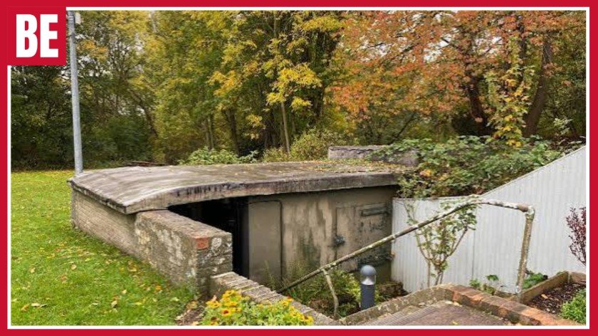
The Battle of Britain Bunker is one of the most significant command centres surviving from the Second World War era in Britain. Located underground in Uxbridge, West London, the facility was the operational command centre of RAF No. 11 Group, playing a part in defending London and south-east England against German air raids. At the site, controllers were able to guide RAF fighter squadrons using information from radar reports, observer reports, and airfield reports. Currently, one can visit the historic plotting room of coloured clock, squadron boards, and communication equipment that dates back to the Second World War era.
Battle of Britain Bunker History and WW2 Importance
The Battle of Britainhistory began during the late 1930s, when British military planners realised that any future war would involve large-scale aerial bombing. An above-ground command centre could be damaged or destroyed, interrupting communication between senior officers and fighter airfields. A reinforced headquarters was therefore built approximately 18 metres below RAF Uxbridge. It included ventilation, electricity, lighting, water, drainage and telephone connections so that military operations could continue during an attack. The bunker became operational shortly before Britain entered the Second World War in September 1939.
The Battle of Britain WW2 role became especially important during the summer of 1940. After France fell and British forces withdrew from Dunkirk, Germany controlled much of Western Europe. Before attempting an invasion across the English Channel, the Luftwaffe needed to defeat RAF Fighter Command. German aircraft attacked British shipping, radar stations, airfields, factories and major cities. No. 11 Group faced some of the heaviest pressure because it defended London, the south-east coast and many of the shortest routes from German-occupied Europe.
Air Vice-Marshal Keith Park commanded No. 11 Group from Uxbridge and used the operations room to manage fighter squadrons across the region. Winston Churchill visited the bunker on 15 September 1940 while major German raids were heading towards London. The RAF successfully challenged these attacks, and the date later became known as Battle of Britain Day. The headquarters continued operating during the Blitz and later supported air operations connected with the Allied invasion of Normandy and the defence against V1 flying bombs.
How the Battle of Britain Uxbridge Worked
The Battle of Britain Uxbridge formed part of the Dowding System, an integrated air-defence network developed under Air Chief Marshal Hugh Dowding. This system connected coastal radar stations, the Royal Observer Corps, filter rooms, group headquarters, sector airfields and fighter squadrons. Radar stations detected enemy formations approaching across the sea and estimated their direction, distance and size. Once aircraft moved inland, trained observers followed their progress and sent reports by telephone.
Information from different stations had to be checked before reaching the Uxbridge operations room. Several radar or observation posts might report the same enemy formation, so specialists removed duplicated or unreliable information. WAAF plotters then displayed the confirmed movements on a large map table using markers and long wooden rods. Each marker usually represented a formation rather than a single aircraft and could show whether it was friendly or hostile, its estimated height, strength, direction and reporting time.
Controllers compared the position of enemy aircraft with the readiness of RAF squadrons based at sector stations such as Biggin Hill, Kenley, Northolt, Hornchurch and North Weald. Orders were sent to the most suitable airfields, where local controllers directed pilots towards likely interception points. This system reduced unnecessary patrols, preserved fuel and prevented pilots from becoming exhausted by remaining constantly airborne. It also allowed Britain to use a limited number of fighters more effectively.
Inside the Underground Operations Room
The main operations room contains the large aircraft plotting table, coloured clock, squadron readiness boards, telephones and raised controller positions that supported fighter control. The central map covered south-east England, the English Channel and nearby parts of continental Europe. Plotters moved markers as reports arrived, creating a constantly updated picture of friendly and enemy aircraft. Senior officers watched the developing situation from positions that provided a clear view of the complete table.
The distinctive colour-coded clock helped staff identify the age of each report. When new information arrived, the marker placed on the map was linked to the colour showing on the clock at that time. As the clock moved into another coloured section, controllers could quickly see which plots were becoming outdated. This prevented old aircraft positions from remaining on the table and misleading decision-makers. Large wall boards also showed whether RAF squadrons were available, preparing to take off, already airborne, returning to base or waiting for fuel and ammunition.
Women serving in the Women’s Auxiliary Air Force played essential roles as plotters, tellers, telephone operators and communications staff. Their work required speed, accuracy and concentration, particularly when several raids were approaching at the same time. A small error could delay an interception or direct fighters towards the wrong area. The room therefore represents more than military technology; it preserves the working environment of the people who turned scattered reports into urgent operational decisions.
Battle of Britain Tickets, Map and Location
The Battle of Britain location is Wren Avenue, Uxbridge, West London, with the postcode UB10 0GG. Visitors using a Battle of Bunker map should search for the attraction’s full name or postcode, as the site is located within the former RAF Uxbridge area. The nearest London Underground station is Uxbridge, which is served by the Metropolitan and Piccadilly lines. The attraction is roughly one mile from the station, and local buses and taxis may provide easier alternatives for visitors who do not wish to walk.
Battle of Bunker tickets are normally available for a combined experience that includes the modern Visitor Centre and a scheduled guided tour of the underground operations room. Exhibition–only admission may also be offered for visitors who cannot or do not wish to enter the historic bunker. Advance booking is recommended because underground tours have limited capacity and leave at fixed times. Ticket prices, opening hours and concessions may change, so visitors should check current information before travelling.
The underground operations room is reached by a long staircase and does not have a conventional lift. This can make access difficult for wheelchair users and people with limited mobility. The modern Visitor Centre is more accessible and may offer a recorded virtual tour for people unable to descend into the bunker. Visitors affected by claustrophobia should also consider the enclosed setting before booking. Comfortable shoes and a light layer of clothing are sensible because the underground environment can feel cooler than the weather outside.
Battle of Britain Photos, Exhibition and Café
Battle of Britain photos commonly show the dramatic plotting room with its central map, green lamps, colour-coded clock, wall displays and wartime communication equipment. The original setting gives these images a sense of authenticity that is difficult to recreate in a modern museum. Visitors should confirm photography and filming rules when they arrive, particularly during the guided underground presentation. Listening to the guide is also important because many objects can appear simple until their operational purpose is explained.
The modern exhibition above ground provides background on radar, Fighter Command, the Royal Observer Corps, WAAF personnel and the wider defence of Britain. Visitors can learn about Keith Park, Winston Churchill’s visit, RAF Uxbridge and the bunker’s role during later wartime operations. The displays explain how every part of the command system worked together. The map showed aircraft movements, the coloured clock showed the age of reports, and the squadron boards identified which fighter units were available to respond.
The Battle of Britain Bunker café provides a convenient place to have a drink, snack or light meal before or after the tour. It is particularly useful for families, older visitors and people arriving early for a scheduled visit. An outdoor seating area may also be available during suitable weather. The Visitor Centre normally includes a gift shop selling aviation books, RAF-themed products and souvenirs. Café menus and opening times may differ from general museum hours, so visitors with specific dietary or timing needs should check arrangements beforehand.
Benefits, Pros and Cons of Visiting
A visit offers valuable historical, educational and practical benefits. The site explains the complete system behind the fighter pilots rather than focusing only on Spitfires and Hurricanes. Students can see how geography, radar, communication and leadership worked together, while families can learn about the contributions of women, observers, engineers and ground crews.
The bunker also provides useful lessons about crisis management, resource allocation, information filtering and decision-making under pressure.
- Authentic setting: Visitors enter the genuine underground operations centre rather than a modern reconstruction.
- Strong educational value: The site explains radar, fighter control, communication and wartime teamwork.
- Expert interpretation: Guided tours make the plotting table, clock and status boards easier to understand.
- Human stories: The displays recognise WAAF plotters, observers, controllers, pilots and ground crews.
- Accessibility limitations: The historic bunker requires visitors to use many steps and has no standard lift.
- Enclosed environment: The underground space may not suit people affected by claustrophobia.
- Limited aircraft collection: It is a command-centre attraction rather than a large museum filled with complete aircraft.
The main strengths are authenticity, historical importance and detailed interpretation. The main disadvantages relate to the original underground structure and the focused nature of the attraction. Young children may find a long historical presentation difficult, while visitors expecting rides or large aircraft displays may prefer another museum. However, people interested in real wartime locations are likely to find the experience highly rewarding.
Is the Battle of Bunker Worth Visiting?
The Battle of Britain is worth visiting for anyone interested in aviation, WW2 history, radar technology, leadership or wartime London. Its greatest strength is that visitors can enter the actual operations room where aircraft movements were plotted and RAF fighter squadrons were directed. The setting creates a stronger connection with history than simply viewing equipment in separate museum cases.
The attraction also provides a broader understanding of the Battle of Britain. Fighter pilots depended on radar operators, Royal Observer Corps members, WAAF plotters, telephone staff, engineers, mechanics and ground controllers. The bunker shows how these different roles were connected through one organised command system. It also demonstrates that accurate information and good timing could be as important as aircraft speed or firepower.
Visitors expecting a large collection of full-size aircraft may prefer a dedicated aviation museum. However, those interested in authentic history, communication technology and military decision-making will find the Uxbridge site highly valuable. The combination of an original underground headquarters, a modern exhibition, guided interpretation and useful visitor facilities makes it one of the most meaningful RAF heritage attractions near London.
Frequently Asked Questions
Is the Battle of Britain Bunker worth visiting?
Yes, it is worth visiting for anyone interested in WW2 history, aviation and authentic military sites. The original operations room offers a detailed and memorable experience.
How deep is the Battle of Bunker?
The bunker is around 60 feet, or 18 metres, below ground. Visitors reach the historic operations room by using a long staircase.
How long is the Battle of Britain tour?
The guided tour usually lasts about 60 minutes. Visitors should allow around two hours for the tour, exhibition, café and gift shop.
What happened to RAF Uxbridge?
RAF Uxbridge closed as an active military station in 2010. Much of the former site was redeveloped, while the historic bunker was preserved as a museum.
Where is the Battle of Britain located?
The bunker is located on Wren Avenue in Uxbridge, West London, with the postcode UB10 0GG. Uxbridge Underground station is approximately one mile away.
Conclusion
The Battle of Britain Bunker gives visitors a unique perspective on the people, technology, and choices behind Britain’s air defence system during the Second World War. The bunker’s intact operations room, plotting table, colored clock, and squadron boards show how radar information was turned into action plans for the fighters. Visitors also learn more about the role of WAAF plotters, controllers, observers, engineers, and ground crew that helped out the RAF pilots. While there are some disadvantages in terms of underground stairway accessibility, the museum is a valuable one overall because of the additional facilities provided by the modern museum.


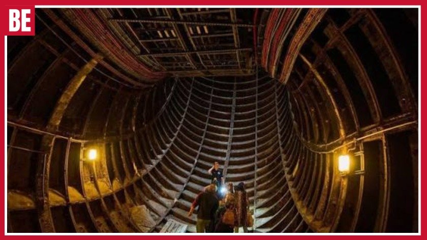
London is known for its landmarks, museums, and historic streets; however, there are many exciting places in this city which are located below ground. Tours called Hidden London allow tourists to visit abandoned Underground stations, historic platforms, corridors, and places linked with wartime London. This type of tour will not only be entertaining since visitors will learn how London’s transport system has been developing as well as how underground spaces have been used in different times. The station Aldwych will be especially attractive for those interested in abandoned Tube stations, and Baker Street will help to trace the history of underground railway travelling.
Underground Tours London Blitz: Discover Wartime History Beneath the City
The London Underground became an important part of civilian life during the Blitz. German bombing raids placed enormous pressure on London and its residents. Many people used Underground stations for shelter during air raids. The stations offered spaces below street level where civilians could wait until the immediate danger had passed. This changed the role of the railway in a significant way. Stations that normally existed to move passengers became important places of protection during a national emergency.
The Underground also continued its transport role throughout the war. Railway workers maintained trains, tracks and stations while London faced repeated attacks. Essential workers still needed to travel around the city, and businesses depended on transport links. The continued operation of the network helped London maintain important connections during a difficult period. This dual role makes the wartime history of the Tube especially interesting because it shows how public transport could support a city in more than one way.
Specialist historical experiences can help visitors understand this period through real Underground locations. Guides can explain how stations operated, why civilians used them and how wartime conditions affected everyday life. Visitors can also learn about the people who maintained the network during the conflict. This creates a stronger connection with history than simply reading a short description online. The physical surroundings provide context and help explain why the Underground became such an important part of London’s wartime story.
Aldwych: A Former Tube Station With a Wartime Story
Aldwych is one of London’s best-known former Underground stations. The station opened in 1907 and remained in passenger service until 1994. Its long history makes it an important example of how London’s railway network changed over time. Although passengers no longer use the station for regular journeys, historic features remain. These details provide clues about the way earlier Underground stations looked and operated.
Aldwych also has a strong connection with the Second World War. Parts of the station were used as a shelter during the war. This gave the building another purpose during a period of great danger. Londoners could use underground spaces while bombing affected the city above. The story adds an important human element to Aldwych because it connects railway architecture with the experiences of ordinary civilians.
The station has several other historical layers too. Its original transport purpose, wartime role, closure and later use as a filming location all contribute to its appeal. A specialist experience can bring these different stories together and show how one place changed across the decades. Visitors should remember that former railway spaces have controlled access and may involve stairs or walking. Checking the latest visitor information before booking is therefore important.
Baker Street and the Birth of Underground Railway Travel
Baker Street tells a different story from Aldwych. Its importance comes from its connection with the Metropolitan Railway and the early development of underground transport. The Metropolitan Railway helped establish the world’s first underground railway. This makes Baker Street an important location for understanding how modern urban transport began.
London experienced rapid growth during the nineteenth century. More people travelled into central areas for work and business. Roads became increasingly busy, creating a need for new forms of transport. Engineers developed underground railways to help solve these problems. Baker Street provides a useful setting for learning about this major change in the city’s development.
The station also contains historic features that can help visitors understand earlier railway design. People interested in engineering can learn about the challenges faced by early railway builders. Railway enthusiasts can explore the development of station layouts and transport systems. While Aldwych offers a stronger connection with abandoned-station and wartime history, Baker Street provides an excellent introduction to the origins of London’s Underground.
Wartime London: What Did People Experience Underground?
The Blitz changed daily life throughout London. Air raids could interrupt work, travel and family routines. People had to respond to danger while continuing essential activities. Underground stations became part of this new routine for many civilians. Some people entered stations during air raids and stayed there while bombing continued.
Life underground could be very different from the short journeys passengers make today. People could remain in stations for long periods. Families and individuals shared limited underground spaces while waiting for the danger to pass. Railway workers also continued their duties and helped maintain transport services. These experiences show how the Underground became closely linked with civilian life during wartime.
Learning about these experiences can give visitors a more personal understanding of the Blitz. The subject is not only about military events or damaged buildings. It is also about ordinary people adapting to difficult conditions. A respectful historical experience can explain how communities responded and why these underground locations still matter. This human perspective can make the history particularly meaningful for students and visitors interested in social history.
What Makes London Blitz Underground Experiences Different?
A wartime Underground experience differs from many traditional London attractions. Instead of visiting a famous landmark above ground, visitors explore a location connected with the city’s transport and wartime history. The physical surroundings help provide context for the stories being told. Historic platforms, corridors and other railway features can make the experience feel more connected to the past.
Another advantage is the combination of several subjects. A single experience may cover railway engineering, architecture, transport development, civilian life and wartime history. Aldwych is a good example because its story stretches across several decades. Visitors can learn about the station’s opening, passenger service, wartime use, closure and later cultural importance.
The guide also plays an important role. A historic platform may not tell its own story clearly to a first-time visitor. A knowledgeable guide can explain why the station was built, how people used it and what happened during the war. This storytelling adds value and helps visitors understand details they might otherwise overlook. The result is an experience that combines sightseeing with education.
Benefits, Pros and Cons of Wartime Underground Tours
One major benefit is the opportunity to learn history in a real location. Visitors can connect historical events with physical spaces rather than relying only on books or photographs. This can make the subject easier to remember. The experience can also introduce visitors to parts of London that they would probably never discover during ordinary sightseeing.
Another benefit is the variety of subjects covered. Railway enthusiasts can learn about transport development. History lovers can explore the Blitz. Architecture fans can examine older station features. Students can connect their studies with a genuine historical location. The experience can therefore appeal to several types of visitors.
Main advantages include:
- Unique historical locations.
- Detailed railway stories.
- Wartime history.
- Knowledgeable guides.
- Historic architecture.
- Educational value.
- Unusual sightseeing.
- Strong connection with London’s past.
There are also some disadvantages. Some experiences involve stairs, walking or standing. Accessibility can vary between locations. Specialist tours may also operate only on selected dates. Some experiences may have age restrictions or serious wartime subject matter. Visitors should check the latest information before booking. Understanding these practical points can help you choose an experience that suits your needs.
Frequently Asked Questions
What are the best underground tours in London?
Aldwych is ideal for disused Tube history, while Baker Street is excellent for railway and Victorian engineering history.
Can you visit abandoned Tube stations in London?
Some former stations are accessible through authorised guided tours, but restricted railway areas should never be entered independently.
Is the Aldwych Underground tour worth visiting?
Yes, especially if you enjoy London’s transport history, wartime stories and historic architecture.
What can you see on an Underground history tour?
You may discover old platforms, historic corridors, lift areas, station features and stories from London’s past.
Are Underground history tours suitable for families?
Some tours are suitable for older children, but check the specific age, accessibility and walking requirements before booking.
Conclusion
Exploring the underground history of London is a unique opportunity for travelers to find out what is unseen by the majority of tourists coming to this city. From the historical environment of Aldwych to the unique story of Baker Street railways, all these adventures include the history of transport, architecture, engineering, as well as wartime stories. All these tours are very important for those travelers who do not want to see what others see in London. One should pay attention to the schedule, the accessibility of the place, the age limitations, and walking conditions before booking one of the tours.

Hidden Manchester is an intriguing site for anyone looking to explore the city’s electronic music and alternative club culture scene. As part of the Downtex Mill location, the club is known for its combination of an industrial environment alongside music, lighting, and club activities. Hidden Manchester has received interest from people who have been searching for tickets, venue capacity, pictures, Halloween activities, and more regarding the environment of the club. Different from a typical commercial night club, it could offer a unique warehouse experience due to its industrial nature. This guide will look into what one should know before visiting the place.
What Is Hidden Manchester at Downtex Mill?
Hidden is associated with Manchester’s alternative electronic music and nightclub culture, with the Downtex Mill setting playing an important role in its identity. The venue is different from many purpose-built commercial clubs because the industrial environment can become part of the entertainment experience. Instead of relying only on polished interiors, the atmosphere can be created through architecture, sound, lighting, visual production and the energy of the crowd. This makes it particularly interesting for visitors who enjoy warehouse-inspired electronic music environments.
The connection with Downtex Mill also reflects Manchester’s industrial heritage. The city grew around mills, manufacturing and trade, and industrial buildings have continued to influence its creative culture. Repurposing industrial spaces for music and entertainment allows visitors to experience a setting that feels connected to Manchester’s past while participating in its modern nightlife. Large rooms, industrial structures and darker interiors can create an atmosphere that feels very different from a brightly designed commercial venue.
It is important to understand that every event may not feel the same. Different promoters can bring different DJs, genres, audiences and production styles to the venue. A techno-focused night may create a different atmosphere from a house event, while a special seasonal party may use additional decorations, costumes and lighting. For that reason, visitors should research the individual event rather than assuming that a general description of the venue tells them exactly what their night will be like.
Capacity, Location and Overall Venue Experience
Capacity is one of the most common practical subjects people investigate before attending a busy nightlife venue. However, visitors should be careful about treating an online capacity figure as a permanent number for every event. The permitted number of people can depend on licensing, safety arrangements, event configuration and which areas of the building are being used. Stages, sound equipment, barriers and other production requirements can also change the amount of usable space during a particular event.
The atmosphere can therefore depend on more than the total number of visitors. A large room may feel relatively spacious early in the evening before becoming significantly busier later. A popular performer or special event can attract a larger crowd, while a smaller event may feel more relaxed. The time you arrive can influence your experience as well, especially if you want to see a particular performer or prefer entering before the venue becomes crowded.
Visitors should check the latest event information for opening times, last-entry requirements, age restrictions and identification rules. These details may differ between events, so information from an older listing should not automatically be applied to a new event. If you are travelling from outside Manchester, plan your route and return journey before the event begins. Understanding the venue environment, event schedule and transport arrangements together will help you prepare more effectively than relying on a capacity figure alone.
Tickets, Entry Requirements and Event Planning
Ticket prices can vary according to the event, date, promoter, performers and ticket-release stage. Some events may use several ticket tiers, meaning the price can change as sales progress. Special events, major artist bookings and seasonal parties may also have different pricing arrangements. Visitors should therefore check the current event listing instead of assuming that an old price found through a search engine is still accurate.
Before purchasing, carefully read the event details and entry conditions. Important information can include the event date, opening time, closing time, ticket price, last-entry time, age requirement, identification rules, promoter and music programme. Last-entry information is particularly important for people travelling from another city because delays can affect arrival. A ticket confirms your purchase, but it does not necessarily mean you can enter at any point during the night if the organiser has specified a final entry time.
It is also wise to be cautious when considering tickets from unofficial sellers. Old event pages can remain visible online even after an event has finished, while third-party listings may contain incorrect information. If an event appears sold out, buying from an unknown seller can create unnecessary risks. Visitors should also calculate the complete cost of their evening, including transport, food and other expenses. A little planning before purchasing can make the entire experience more straightforward.
Photos, Downtex Mill and the Industrial Atmosphere
People searching for venue photos often want to understand what the location looks like before attending. Images can show the industrial surroundings, interior spaces, lighting, stages and crowd atmosphere. This can be particularly useful for first-time visitors who want a clearer idea of the environment before choosing an event.
When looking at recent photographs, consider these useful details:
- Industrial architecture: Look for the building’s distinctive warehouse-style features.
- Interior layout: Photos can give an idea of the main spaces and event arrangement.
- Lighting: Event lighting can dramatically change the atmosphere.
- Stage production: Images may show screens, speakers, DJs and visual effects.
- Crowd size: Recent photographs can provide a general impression of how busy an event becomes.
- Event style: Different promoters may create different visual experiences.
Photographs cannot completely reproduce the atmosphere of a live nightclub. The same space may look very different before an event compared with a busy night filled with music, lighting and people. Recent event images are therefore more useful than relying only on older promotional photographs. Combining photos with the event description, music style and line-up can give visitors a more realistic idea of what to expect.
Halloween, Special Events and Club Nights
Halloween can be an especially interesting time for an industrial nightlife venue because the setting can complement themed decorations, costumes, lighting and electronic music. A Halloween party may offer a different atmosphere from a standard club night, particularly if the organiser introduces special performers, visual effects or a particular theme. For visitors who enjoy seasonal nightlife, this can make the event feel more like a special occasion than an ordinary night out.
However, visitors should always research the specific year’s Halloween event rather than assuming that previous events will return in exactly the same form. Organisers can change the date, theme, line-up, ticket prices and production. Regular events can also vary considerably depending on the promoter. One night may focus on techno, another may centre on house or another electronic style, and each can attract a different audience.
Before choosing a Halloween or special event, consider the music genre, performers, event theme, ticket cost, opening time, last-entry policy and expected crowd. If you are attending with friends, agree on where you will meet and how you will travel home before entering. Costume requirements should also be checked because some events may have restrictions on particular accessories or items. Planning these details in advance can help you focus on enjoying the event rather than solving practical problems later.
Hidden Club, The Loft Manchester and Manchester Nightlife
People searching for Hidden club or comparing it with other venues such as The Loft Manchester are often looking for the right type of nightlife experience rather than simply asking which venue is most popular. Manchester has a broad nightlife scene that includes mainstream clubs, independent electronic music venues, live music spaces and industrial-style locations. Its musical history and industrial background have both helped shape the character of this scene.
The industrial approach can appeal to people who enjoy warehouse-style electronic events. Instead of concentrating mainly on polished decoration or luxury interiors, this kind of venue can place greater emphasis on music, sound quality, lighting and the atmosphere created by the building. This can make it particularly appealing to people who want an alternative night out. However, the experience still depends heavily on the event, promoter and audience.
When comparing different Manchester clubs, consider your own priorities rather than relying only on online popularity. Think about the music genre, DJ line-up, ticket price, location, crowd, event duration, venue design and atmosphere. Someone who enjoys underground electronic music may prefer an industrial venue, while another visitor might prefer a quieter bar or a conventional commercial club. The best nightlife choice is ultimately the one that matches your expectations and interests.
Is It Worth Visiting? Pros and Cons
The venue can be worth considering for people who enjoy electronic music, energetic club nights and distinctive industrial surroundings. Its setting is one of its main strengths because the architecture can contribute to the atmosphere rather than simply acting as a background. Different promoters and artists can also provide variety, meaning visitors may find different styles of events throughout the programme.
There are potential disadvantages as well. Industrial nightlife is not everyone’s preferred style, particularly for people who enjoy luxury interiors, quieter spaces or lots of seating. Busy events can involve crowds, loud music and extended periods of standing. Transport is another consideration for people unfamiliar with Manchester. These factors do not necessarily make the venue unsuitable, but they are worth considering before buying a ticket.
The most sensible approach is to choose the event rather than simply choosing the venue. Look at the music, performers, event description, ticket conditions and expected atmosphere. If those factors match what you want from a night out, the industrial setting can add something memorable to the experience. If they do not, another Manchester venue may be a better choice.
Frequently Asked Questions
Where Is Hidden Manchester Located?
Hidden is associated with the Downtex Mill setting in Manchester. Check current event details for the latest entrance information.
Who Owns Hidden Club Manchester?
Hidden has been associated with Kristian Arnaoutis and Nickos Arnaoutis. Ownership and management details can change over time.
What Is the Capacity of Manchester?
Published information has commonly listed the capacity at around 650 people. The actual capacity can vary depending on event arrangements.
What Type of Music Is Played at Manchester?
The venue is associated with electronic music, including techno and house. Music styles can vary depending on the event.
What Is the Most Famous Nightclub in Manchester?
The Haçienda is one of Manchester’s most famous historic clubs. The Warehouse Project is also widely recognised for modern electronic music events.
Conclusion
Hidden Manchester provides an unusual nightlife destination for those who love electronic music and lively events as well as the industrial feel of the place. The connection to Downtex Mill makes Hidden Manchester stand out among most other Manchester clubs. People will have an opportunity to visit different kinds of events, listen to various kinds of music, and even attend themed parties according to the schedule. It is crucial to find out the ticket price, opening hours, entry conditions, event details, and transportation before visiting the place. Photos from recent times will give some understanding of the venue.
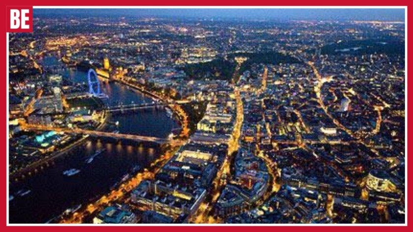
The history of the British landscapes is full of changes, growth and human intervention over different generations. Although documents and maps play an important role in providing information about the past, aerial photographs offer unique insights into the ways in which places have changed over time. Through Britain From Above people can discover the historical perspectives of towns, cities, villages and rural landscape areas by viewing high quality aerial photographs. This will help in understanding what the places used to look like, including the lost buildings, communities, transport routes and industries that built Britain as we know it today.
What Is Britain From Above and Why Are Historical Aerial Photos Important?
Historical aerial photography is the process of capturing landscapes, towns, and communities from above to create a visual record of places at specific points in time. Unlike traditional photographs that focus on individual buildings or objects, aerial images provide a wider perspective by showing how roads, homes, industries, and natural environments connect. This broader view helps researchers understand how locations developed and why certain areas grew in particular ways. Aerial photographs have become important resources for studying changes in British landscapes because they show details that may no longer exist today.
The importance of old UK aerial photos comes from their ability to preserve evidence of change. Cities expand, villages grow, factories close, and countryside areas are transformed by modern development. A location that appears completely different today may have once contained farmland, railway lines, industrial buildings, or historical communities. By comparing photographs from different periods, researchers can understand how Britain evolved socially, economically, and environmentally.
Archive aerial images also provide valuable information about everyday life. They do not only capture famous landmarks but also show ordinary streets, workplaces, schools, farms, and neighbourhoods. Historians use these photographs to study development patterns, families use them to explore local connections, and communities use them to protect memories of places that have changed. These visual records help create a stronger connection between the past and the present.
Britain From Above 1919 to 1953: Exploring Britain’s Historic Aerial Photography Collection
The period between 1919 and 1953 represents one of the most valuable eras in UK aerial photography because it captured Britain during a time of major transformation. After the First World War, the country experienced rebuilding, industrial changes, population growth, and urban expansion. Early aerial records from this period provide a rare opportunity to see towns, cities, villages, and countryside areas before many modern developments changed their appearance.
The 1919 to 1953 aerial photographs show important details about early twentieth-century Britain, including railway networks, factories, ports, agricultural landscapes, and growing residential areas. Many locations shown in these photographs have changed significantly because of redevelopment and modern construction. These images help researchers understand how communities expanded and how industries influenced the growth of different regions.
The years around 1939 are particularly significant because they capture Britain during the beginning of the Second World War. Wartime aerial photographs provide evidence of industrial areas, transport systems, coastal locations, and communities during a period of national change. These images help historians compare landscapes before and after the war and understand how rebuilding and modernisation shaped Britain in the decades that followed.
How to Explore Old UK Aerial Photos and Historic Aerial Images
Exploring old UK aerial photos allows people to discover how familiar places looked many decades ago. A modern street, town centre, or countryside area may have a completely different history hidden beneath today’s buildings. Historical images can reveal previous land use, forgotten structures, lost transport routes, and changes in community development that are not always visible from ground level.
Many people use historic aerial collections for family research, local history projects, and educational purposes. A person researching their family background may want to understand the environment where previous generations lived. Local communities can use photographs to preserve memories and create records of how their neighbourhoods changed. Researchers can compare images from different periods to study urban growth, industrial development, and environmental changes.
Digital archives have made these resources easier to access. Modern platforms allow users to search locations, compare historical and current views, and explore changes across decades. These collections provide a valuable learning experience because they transform ordinary locations into historical stories and help people understand how places developed over time.
Benefits and Real-Life Uses of Archive Aerial Photographs
Archive aerial photographs provide benefits across many different fields, including archaeology, education, environmental research, property development, and heritage preservation. Because these images capture entire landscapes, they help researchers understand relationships between buildings, roads, natural features, and communities. They provide information that cannot always be discovered through written records or modern photographs alone.
Archaeologists use aerial images to identify hidden historical features such as old settlements, pathways, boundaries, and structures that may no longer be visible. Environmental researchers study changes in forests, rivers, coastlines, and farmland by comparing photographs from different periods. Students also benefit because aerial photography makes geography and history more practical by allowing them to study real examples of landscape change.
Professionals in architecture, property, and urban planning also use historical aerial records. Before developing land, experts can examine how an area was previously used and understand its development history. These photographs can reveal former industrial sites, transport connections, or environmental features that may influence future decisions. This makes aerial photography useful not only for understanding the past but also for planning the future.
Digital Archives, Online Access and the Future of Aerial Photography
Digital technology has transformed how people access historical photography collections. In the past, researchers often needed to visit specialist archives to view old images, but modern online systems allow people to explore collections from anywhere. Digital preservation has also helped protect fragile photographs by creating secure copies that can be studied for generations.Historical aerial photographs are useful across many different fields because they provide visual evidence of change. Archaeologists, researchers, educators, planners, and local communities use these images to understand how places developed.
Common uses of historical aerial photography include:
- Archaeological discoveries and landscape research
- Local history and family research
- Geography and history education
- Environmental monitoring and conservation
- Property and land development research
- Urban planning and infrastructure studies
Online archive systems allow users to search by location, date, and subject. Mapping technology has improved the experience by connecting historical photographs with modern geographical information. This allows researchers and the public to compare previous landscapes with current environments and understand how places have changed.
The future of aerial photography will continue to develop through improved mapping tools, artificial intelligence, and advanced image analysis. New technology may create more interactive ways to explore historical landscapes, including detailed comparisons and immersive experiences. However, the original photographs will always remain important because they provide authentic evidence of Britain’s changing environment and communities.
Why Exploring Historical Aerial Photography Is Worthwhile: Pros, Cons and Final Value
Exploring historical aerial photography is valuable for anyone interested in history, geography, architecture, or local communities. The greatest advantage is the perspective these images provide. They show connections between landscapes, buildings, and communities that are difficult to understand from ground level. A single photograph can reveal decades of development and explain why a location looks the way it does today.
The main benefits include preserving historical information, supporting research, improving education, and protecting local heritage. However, there are also some limitations. Older photographs may have lower image quality, some areas may have fewer available records, and additional research may be needed to understand the reasons behind certain changes.
Despite these challenges, historical aerial collections remain extremely valuable. They combine photography, history, and technology to create a unique way of exploring Britain’s development. These images preserve stories about industries, families, communities, and landscapes, allowing people to discover the hidden history behind the places they know.
Frequently Asked Questions
What are historical aerial photographs?
Historical aerial photographs are images taken from above that show landscapes, buildings, and communities during previous periods. They are used for research, education, and understanding how places changed over time.
What makes 1919 to 1953 aerial records valuable?
The 1919 to 1953 period captured major changes in Britain, including post-war development, industrial growth, wartime transformation, and urban expansion. These photographs provide evidence of a changing nation.
How can old aerial images help local history research?
Old aerial images can show previous buildings, roads, industries, and landscapes connected with local communities. They help researchers understand how neighbourhoods developed.
Why are wartime aerial photographs important?
Wartime aerial photographs provide information about locations during significant historical events. They help researchers study changes before, during, and after periods of conflict.
Can aerial photographs be used for professional research?
Yes. Architects, planners, environmental researchers, and property professionals use aerial photographs to understand land use, development patterns, and environmental changes.
Conclusion
Aerial photography is a special tool for understanding the change of British landscapes, communities, and industrial sites. The images give an opportunity to preserve the stories of the places that may look totally different now. From old twentieth-century documents to new digital collections, aerial photographs play an important role in academic work, learning, preservation of heritage, and even in personal discoveries. They let people learn about places which were forgotten, find out more about local history, and get to know about the evolution of urban and rural settlements. They are an amazing link between the past and the present.

Best Places to Visit in UK Top Destinations

Vernon Kay Biography Age Wife Career

Best Beaches in UK Top Places to Visit
-

 Uncategorized2 months ago
GB News Presenters Female Current Hosts Newsreaders and Journalists
-

 Uncategorized2 months ago
Good Morning Britain Presenters Today’s Hosts and Political Team
-

 Uncategorized2 months ago
Shefali Oza Biography Age BBC Career Husband and Net Worth
-

 Uncategorized2 months ago
Rip Off Britain Presenters Ages Cast Hosts and Everything You Need to Know
-

 Things To Do2 months ago
Universal Studios Great Britain Opening Date Rides Map and Location
-

 Uncategorized2 months ago
Pride of Britain Awards How to Nominate a UK Hero
-

 Uncategorized2 months ago
Emily Campbell Weight lifting Career Olympic Medals and Life Story
-

 Uncategorized2 months ago
Great Britain at the Winter Olympics Medals Full History